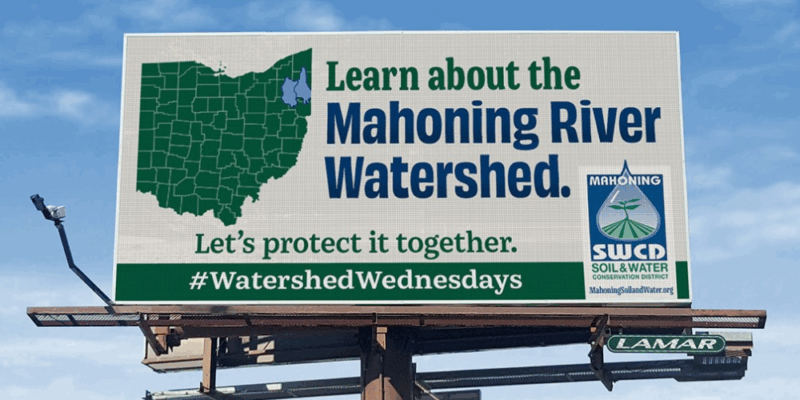
Discover the Mahoning River Watershed
Mahoning County, OH — The Mahoning River watershed is one of northeastern Ohio’s most important natural resources. Covering 1,085 square miles across seven counties in Ohio and western Pennsylvania, the watershed supports drinking water, recreation, wildlife, and local economies. Communities such as Youngstown, Warren, Alliance, and Lordstown all depend on the Mahoning River and its tributaries for their health and growth.
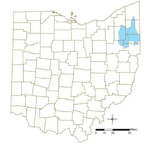
Photo courtesy of Ohio Environmental Protection Agency
The Upper Mahoning River Watershed
The Upper Mahoning River Watershed spans 66,000 acres and is home to Berlin Reservoir and Lake Milton—two major recreational lakes managed by the U.S. Army Corps of Engineers. These reservoirs are vital for flood control, boating, fishing, camping, and wildlife habitat.
Much of the land in the upper watershed is agricultural, with Smith, Western Goshen, Berlin, and Milton Townships making up much of this region. Farms, hayfields, and pastures define the landscape, directly influencing the water quality and health of the Mahoning River system.
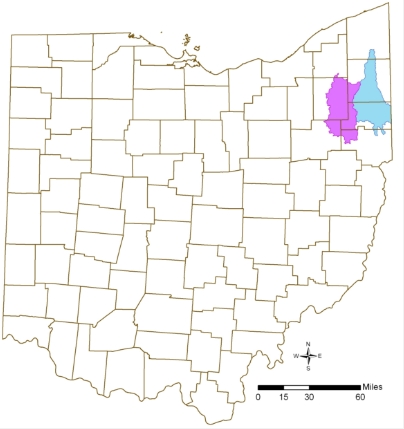
Photo courtesy of Ohio Environmental Protection Agency
The Lower Mahoning River Watershed
Downstream, the Lower Mahoning River Watershed covers 40,000 acres, including McKelvey Lake and portions of the Mahoning River that run through Youngstown, Campbell, Lowellville, Struthers, Austintown, Coitsville, Poland, and Boardman Townships.
This section of the watershed is highly urbanized, with a blend of industrial, commercial, and residential development. The lower watershed has historically been impacted by manufacturing, but it is also a focus of ongoing restoration and watershed protection efforts.
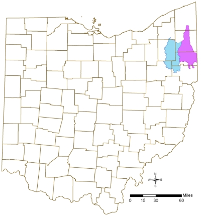
Photo courtesy of Ohio Environmental Protection Agency
Mahoning River Tributaries and Reservoirs
The Mahoning River watershed includes not only the mainstem of the Mahoning River but also several major tributaries, including:
- Eagle Creek
- Mosquito Creek
- West Branch
- Meander Creek
- Mill Creek
- Yellow Creek
Many of these tributaries have been dammed to create reservoirs that supply drinking water, provide recreation, and protect communities from flooding. Key reservoirs include:
- Mosquito Creek Reservoir
- West Branch (Kirwin) Reservoir
- Berlin Reservoir
- Meander Reservoir
- Lake Milton
These interconnected waters form the backbone of the Mahoning River watershed, sustaining thousands of residents and supporting both natural ecosystems and regional economies.
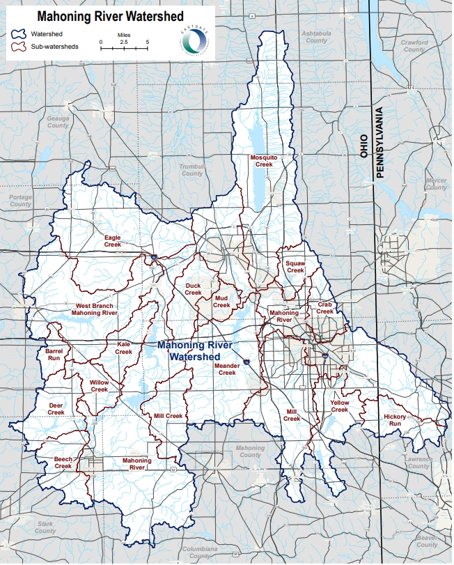
Photo courtesy of Eastgate Regional Council of Governments
Protecting the Mahoning River Watershed
The Mahoning River watershed tells a story of resilience, history, and renewal. From the farmlands of the upper watershed to the urban centers of the lower river, the health of the Mahoning impacts everyone.
By learning about this river system and practicing watershed conservation, residents can help protect clean water, restore habitat, and ensure the Mahoning River continues to thrive for generations to come.
The Mahoning River connects us all. Together, we can protect the watershed, restore its streams, and celebrate its role in our communities. Let’s protect it, together.